
Eclipse Maps

Eclipse Maps
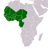
These maps show the paths of central eclipse for 164 total solar eclipses visible in Africa in the period A.D. 1000 to 2000. It is hoped that they may suggest periods and areas where records of eclipses might be found in oral tradition or other sources, and also that they, or their originals, will assist in at least the preliminary stages of identifying such a record with a particular eclipse. The originals have been drawn on a scale of 1: 10,000,000, and photographic copies of these and the master grid are available, on indestructible plastic, price £7. 10s. the set, from the Editors of the Journal of African History.
CITATION: Gray, Richard. Eclipse Maps . : , 1965. Journal of African History Vol.6,no.3,1965,pp251-262 - Available at: https://library.au.int/eclipse-maps-2